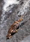
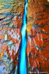
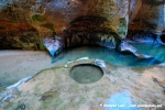
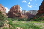
On the hike at the wave Mathias and Bianca told me that they had been at the Subway around 2 weeks ago and had arrived too late for god shots at the tube. They told me that it is important to start early and arrive before 1 pm otherwise the sun would alread shine into the subway and good fotos would no longer be possible.They gave me also some good hints on marking the startpoint at the river with a waypoint cause its sometimes not easy to find the way back on the return. I got up therefore this morning really really eralier (around 5 pm) and checked out at the Motel in Hurricane. There was no possibility for a coffee so I drove directly to the Northfork trailhead which is 10 miles north of Virgin on the Kolob terrace road. I arrived at 6.30 am at the Leftfork trailhead and came to conclusion that this is to early to start the hike. So I used the time to drive some more miles north on the Kolob terrace road enjoing an amazing sunrise towards Zion valley mountains. I was back at 7 am at the trailhead and started the deep descent towards the North Creek. As recoemmended I set a waypoint at the sign to mark the trail for the return. Down at the North Creek there was a trail on both sides of the river and I had fun to find my way along the river, always checking for a good place to cross the river and always avoiding to dirt or wet my hiking shoes. I was in a good mood and knew that I was early (7pm) and had to walk around 3 to 4 hours to arrive at the Subway. So I took plenty of time to search for good shots and I did not notice that the time was passing very quickly. At a big rock facing to the river I noticed a group of frogs and I spent around 15 minutes here for some shots. Later I arrived at the cascades and the crack and spent at least 30 minutes again to setup tripod and doing several photos. When I arrived at the Subway I first of all did not recognize it compared to the photos i had seen. The subway is open towards the sky. I had always believed its a real tube. Entering the Subway at acetain point it was no longer possible to avoid walking in the water. When I looked back the first time I noticed the light was not good for photos, and immediately looked at my watch: It was alread 12:15 noon. I had spent more than 5 hours for the hike. I had consumed al my tining advance and still arrived too late. Of course I regretted not having checked the time more often and noticing that I got delayed by admiring the natures beauty along the hike. Nevertheless I took my photos walking the whole time in the water. I spent around 1 h at the tube. I knew that I had to drive back to Las Vegas at the evening (3h drive) so my way back to the trailhead I did no longer care about wetting the shoes nor did I spent long time to find the best point to cross the river. I didn’t care to walk into the water as the shoes were already wet. I had a quick pace and not photographing anymore it took me aonly 2 hours back to the sign which marks the climb up to the car park and trailhead. It took me another 30 minutes for the steep climb. I relaxed a little bit at the car and then my next destination was again the Flamingo in Las Vegas were I would stay he last three nights and relax a little bit.
|
|||
|
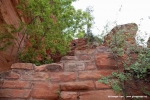
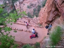
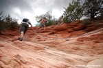
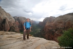
The day started very early at 5.30 a.m. checking out at Flamingo Hotel and taking I-15 north for a 2h45min drive towards Zion N.P. in South Utah. I was really looking forward to this long awaited hike. I had read so much and seen so many nice fotos of this hike. Originally I had planned to do it in my 2008 tour. Unfortunately there was heavy snow back then and I had to postpone. Now the day has come and i was so curious to experience myself how difficult and beautiful this hike is really. I had had no breakfast before arriving in Springdale where I used a refueling stop to have a quick Mc Donalds cappuccino.I arrived at the Zion N.P. visitor center around 10:30 a.m.Here I took the shuttle bus to The Grotto stop, the trailhead to the Angels Landing hike. The weather was sunny when I crossed the bridge over the Virgin river spotting the first time the Angels Landing. Seen from here it looked really high. I could not imagine how the trail could overcome this altitude so quick, particularly cause the hiking trail was yet not visible. After a long left curve the ascent came to view leading steep to the refrigerator canyon. Hiking along the canyon I reached soon Walters Wiggels, a steep zig-zag serpentine trail. They helped quickly overcome altitude and the first viewing area Scout Lookout was now near. I first thought havin arrived already on Angels Landing, cause the view from here into the valley was already awesome. Looking to the left I noticed that Angels Landing was still some 30 minutes ahead, another steep hike along a chain. Unfortuantely the weather had worsen during the ascent, big clouds were announcing rain. So I enjoyed the views from Scout lookout only shortly and continued along the chain towards Angels Landing plateau. It was around noon time already and many people where on the way to and from the plateau, so it got sometimes narrow at the chain and the rim hike. When I reached the Angels Landing plateau I made plenty of photos and then the rain began and urged all hikers to climb back to Scout Lookout. The Hike down to the Grotto shuttle stop was easy. Down at the Vigin river the weather had again changed, sun was back again and the clouds had disappeared. It was 3 pm now and my plan was to do some sunset photos at Bryce Canyon where I had booked a night at the historical Ruby’s Inn. After 2 h drive and a photo session at sunset point I had a very nice steak dinner with red wine at Ruby’s Inn. I went to bed early. Related Posts: |

