Sunday, 7th of October 2012 at 08:14:40 PM

Herzogstand Heimgarten Hike 2012

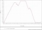
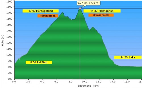
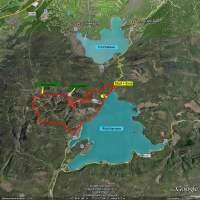
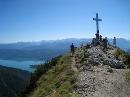
Like every year I hiked the Herzogstand Heimgarten loop hike, my favourite home hike. I started 6.45 from home and arrived at 7.50 at the parking lot near Urfeld. Exactly at 8.00 I began my hike towards the first mountain which is Herzogstand (1731 m). This is the most exhausting part of the hike cause its a steep uphike over 2 hours. Arrived there at 10.00 am. After short break continued over the rim towards Heimgarten Peak (1790 m). This is the most beautiful part of the hike with amazing views into the Alps in the south and the lakeland in the north, as well as to Lake Kochelsee and Lake Walchensee right to ones feet. Due to socalled  “Foehn” winds the visibility was extraordinary. The next part of the hike is an endless long downclimb from Heimgarten peak (1790 m) to the Lake Walchesee level (800 m). Finaly a nice last 5 km walk along the lake back to the car park for a total of 20 km hiking distance.

Get the Flash Player to see the wordTube Media Player.

Google Earth tour over my hiked gpx track.
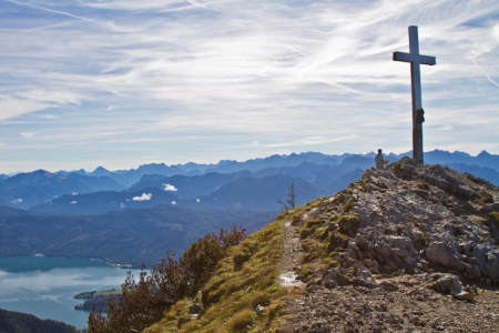
Arriving at Heimgarten peak (1790 m) at noon. View to the north into the alps with the Lake Walchensee beneath.


Related Posts:

Friday, 5th of August 2011 at 05:18:38 PM

The Herzogstand – Heimgarten Hike 2011

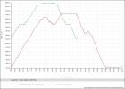
After my hikes on my GSNM phototrip in may/june this was my first long home hike in 2011. Like every year I hike the Herzogstand to Heimgarten rim loop starting in Urfeld.  A total of 20km (12.5 miles) and a summed elevation difference of 1376 m (4500 feet) in climbing.This year it took me 2h from Urfeld to Herzogstand peak, 1h on the rim from Herzogstand to Heimgarten 2 hours down to Walchensee village and finally another hour back along the Walchensee lake back to the car park. This time I had exactly tracked the Hike on the GPS to compare it with one of the more strenous hikes in USA, the Observation point hike. Doing those hikes in US I never could really rank how difficult they were. The Observation point hike in Zion N.P. was with 4h quite short but the one I had the most elevation difference. I was surprised when comparing the GPX tracks that the summed height difference there was only 780 meter (2560 feet).. In both hikes my pace was quite high being in good shape this year. Hope this gpx and screen logs will motivate me in the coming years to keep the pace and shape.

here my 2011 GPX track of the Herzogstand-Heimgarten loop hike

Related Posts:

Sunday, 13th of June 2010 at 06:11:55 PM

The Herzogstand - Heimgarten Hike 2010

Last year I was in bad shape it took me 7 1/2 hours for the whole hike. Kind of alarming. This year I have improved again. 1 1/2 hour to Herzogstand, 1 hour on the rim and 2 h descent and finally 1 hour back to the car. In total 5 1/2 hour, … back to normal!

Related Posts:

Tuesday, 1st of September 2009 at 10:34:53 PM

The Herzogstand-Heimgarten Hike 2009

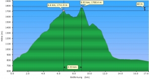
They had announced this would be the last summer day of 2009. I try to do this hike once a year so, this year after 2007 and 2008 the 3rd time.  Being owner of a Oregon 300 GPS since my last US trip, I could for the first time log my hike and create following profile out of the gpx.log.

It took me 7 1/2 hours this year. Never been so slow.  The weather was fantastic.   The view towards the north (Starnberg Lake, Ammersee) and to the Alps was amazing. The hike itself can be divided in 4 parts:

  • 6 km steep climb of 1000m altitude towards Herzogstand peak (2 h). The “exhausting” part.
  • 2 km along the rim between Herzogstand and Heimgarten (1.5 h). The “Nice” Part!
  • 1000 m in 3km descent from Heimgarten towards Walchensee. The “endless” Part!
  • 4 km along the Walchensee shore back to the car park near Urfeld. The “tired and aching” part!

Google Earth KML file    (save as .kml ->you need Google Earth installed)

GPX File

All the fotos of this hike

Related Posts:

Sunday, 27th of July 2008 at 10:50:44 AM

Herzogstand-Heimgarten 2008

In 2007 as a preparation for my 220 km hike on the Camino de Santiago I had done the Hike to the Herzogstand (1730m). I was  in good shape then and it had took me 6 hours of quick hiking for the whole roundtrip. This year I am little bit fatty and not in good shape but I wanted to recheck if I can still do that hike in 6 hours. The hike starts in Urfeld upper forest parking lot at around 850m and in 1 h 30 min of steep nonstop climbing along a forest road I reached (totally wet from sweating) the Herzogstandhaus (1575 m). Another half hour later I reached the peak of the Herzogstand (1730 m) were I had a 10 min break with a Brezel and lot of water. I already knew that I am slower this time then the year before.

View from Herzogstand Peak (1730m) along the ridge to the Heimgarten Peak (1790m)  in the background.

The most beautiful part of the Hike is the ridge between the Peaks of the Herzogstand to the 60m higher elevated Heimgarten (1790 m). You have nice views to the Kochel Lake and the Lake Walchensee. Its always adventurous to do a ridge hike and here you have always these nice views down to the Kochel- and Walchen- Lakes, and to the Alps and you can see also very good to Lake Starnberg in the distance. Another Break at the Heimgarten where I stayed a little bit longer to enjoy the views and to relax, cause meantime I was really tired.

View back from Heimgarten to the Herzogstand peak with Lake Walchensee on the right.

Finally the easy part, another 2 hours walk down the Heimgarten from 1790m down to 850m at the small village of Walchensee directly at the same named Lake. The last part then the 4 km back to the car parking in urfeld  along the Lake  took me another 45 minutes. This year the whole trip took me 6h 30.

Down at the Walchensee Lake, view to the Jochberg (1570m).

Related Posts: