Thursday, 18th of April 2013 at 08:56:56 PM

Canyonlands 2013 day 8: Temples of Sun and Moon – Arsenic Arch – False Kiva

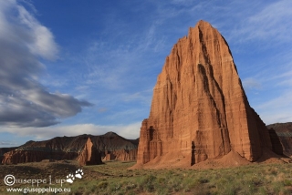
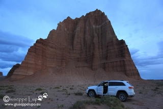
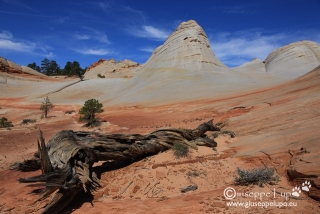
I woke up at 5 am behind the “Temple ofthe Sun”. I had slept bad, cause my legs were full of stings from the Coyote Gulch Hike in Shorts. Furthermore  heavy windstorms in the night, woke me up again and again. It was still cloudy in the morning but I found a nice moment to take this foto of the Temple of the Sun (foreground) and Moon (back). I had parked my Car, for Sleeping in it. right between those two landmarks. Nobody did complain. But nobody was there.

sunrise at the Temple of the Sun (and Moon in the back)

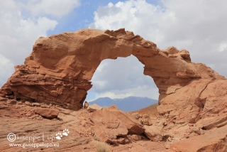
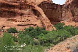
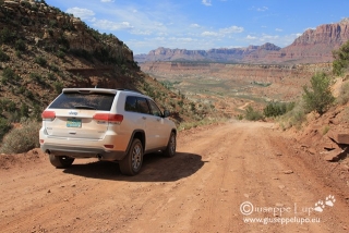
Then I drove down the Cathedral Valley back to US24 and took eastern direction to Hanksville. I had a good Omelet (Rio Bravo style) in Hanksville, and then I drove around 30 miles south to hike to the Arsenic Arch. It’s trail head is located 5 miles east of the Highway and reachable through a sandy road. Therefore I was little bit concerned when I was at Arsenic Arch and it began to rain. It was only a  shower.

Arsenic Arch

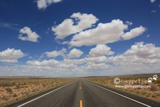
When I returned from the Arsenic Arch Hike it was noon and excellent to do the transit to Moab, a 2h30 drive. During noon time photographing is not very fruitful.

Road tripping USA Southwest

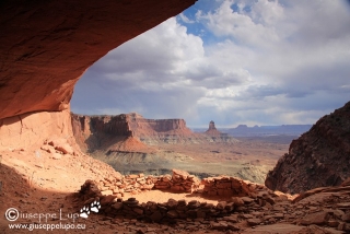
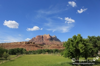
In Moab I drove to the Canyonlands (Island in the Sky) Visitor Center to pickup my permit for the next days (sunday) adventure. Then I drove to White Rim and Buck Canyon Viewpoint and finally I drove to the False Kiva Trail head for a short 3 mile round trip evening Hike. I like that spot very much, It’s not mentioned in the official Park Guides but I knew it through the brilliant book series “Photographing USA Southwest from Laurent Matres.”

False Kiva

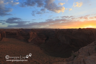
Finally I had a look at the Shafer Trail Switchbacks where I had planned to drive down the second time after 2011.

Shafer trail Switchbacks

Hiking Mileage today:   5.6 km /  3.5 miles

Hiking Mileage total:    99.0 km / 61.9 miles

curious incidents today: it began to rain when I arrived at Arsenic Arch

Related Posts:

Thursday, 18th of April 2013 at 08:55:39 PM

Canyonlands 2013 day 7: Cathedral Valley

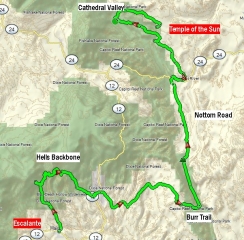
Today I lefft the town of Escalante, UT and wanted to relax from the previous Hikes by driving some Backways and challenge the Jeep. First I took the Hells Backbone Road which starts in Escalante and leads to the Dixie Forest Mountains and Posey Lake. It was a unpaved Gravelroad in good condition and not very scenic.Only the Canyon at the Mountain Peak was really impresive. I took some shots and drove the mountain down back to US12 at Boulder, UT.

250 miles of back roads

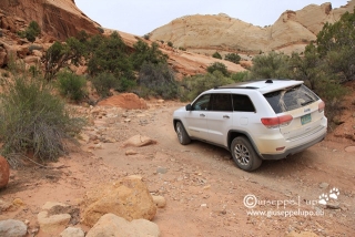
In Boulder I used the Burr Trail Road to visit the Trailhead to the Strike Valley Overlook. The final 2 miles are only accesible with High Clerance and 4WD and for me it was really a good exercise to drive the rocky road.


4WD road to Strikevalley overlook Trailhead

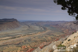
Strikevalley Overlook

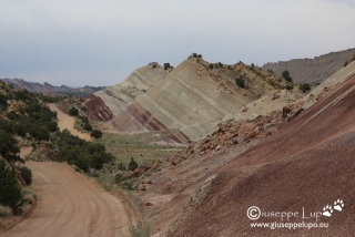
Then I drove down the Burr Trail Switchbacks and took the  Notom Bullfrog Rod into northern direction, driving along the Waterpocket fold. It reminded me of a large scale version of the  Cockscomb at the Cottonwood Canyon road near Page, Az.

Notom Bullfrog Raod

Finally I drove up to Capitol Reefs Upper Cathedral Valley. Adventurous the drive through the river Ford to reach the Hartnet Road. Then a long drive up the bumpy road to Upper Cathedral Valley where I arrived little bit late for the sunset shots.

Upper Cathedral Valley at sunset

I wanted to camp at the Upper cathedral Valley campground. But it was already full. I was told I could carcamp everywhere in the Park region. Because I wanted to shot sunrise at Temple of the Sun and Moon I continued my drive down to Temple of the sun where I passed the night in the car.

Carcamping right behind the Temple of the Sun

Hiking Mileage today:   1.6 km /  1 miles

Hiking Mileage total:    93.4 km / 58.4 miles

curious incidents today:

1) 4WD road to Strike Valley Overlook remarkable

2) car camping behind the Temple of the Sun.

3) I have counted 25 stings on my legs. (from the Coyote Gulch Hike in Shorts)

Related Posts:

Thursday, 18th of April 2013 at 08:54:44 PM

Canyonlands 2013 day 6: Coyote Gulch

Today was completly reserved for hiking the Coyote Gulch. I had been here in 2009, but hat entered only 2 miles up the canyon due to limited time. Honestly I was little bit unsecure if I might have planed a too long hike. This time by overnighting and the trailhead I could start as soon as it began to dawn (5.30am). It is a 1.9 mile hike down to the “Crack in the Wall”, one of only 3 possible access points to the Canyon. At the crack I arrrived in time to admire the sunrise over the lower escalante canyon.

Sunrise seen from atop Crack in the Wall

The crack in the wall is very narrow opening of two sandstone ledges and I had two remove all my stuff from the backpack and go 3 times through the crack carrying camera gear, water and the empty backpack separately through the crack. The crack at its narrowest point is only about 0.3 m wide. Thus big people wouldn’t fit through it.

After the crack opens the magnificent panorama of lower Escalante Canyon and confluence of Coyote Gulch. Now the trail leads down a steep sand dune, which is great to hike down but definitely strenuous hiking back up. The elevation difference is about 700 feet. It is a 0.9 mile hike down the sand dune to reach the canyon bottom. I had planned a total 30 km / 18 miles hike and was concerned how many energy would be left at the end of the day, to climb up the sand dune back to the car. Down in the canyon you just walk up the Coyote Gulch, often you need to walk through the water which is fun and refreshing. I had brought my water shoes for this, to not ruin my good hiking boots. The Gulch is very scenic but due to its remoteness and difficult access you find few people down there. Hiking in 2009 I did not see a person beside me. This time near the Cliff Arch I met a group of 4 photographer’s with heavy digital medium format cameras.  It was interesting to see them work with their specialized cams. I was curious and chatted with one of them. It was Landscape photographer Joseph Holmes, which I did not know but looked up later with Google.  This guy was very likeable and he patiently answered all my questions although he was in the middle of shooting a motif. He had really a positive aura, liked him immediately.
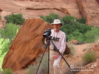
Joseph Holmes photographing in Coyote Gulch

I met those four photographers again on my way back out of the canyon. Now i continued towards my target which was Jacob Hamblin Arch, it is located 6 miles up the canyon. I arrived there at 10.30 am. It is a gigantic arch and was hard to photograph, cause the sun lit it only partly and there was much shadow too.

Jacob Hamblin Arch

I began my hike back at around 11 am. I knew that know the light for photographing was infavorable but consoled myself that my main purpose was to reach Jacob Hamblin Arch. I arrived at 12.30 pm at the Coyote Natural Bridge.

Coyote Natural Bridge

The next landmark towards the confluence with Escalante river was the Cliff Arch were I arrived around 1.30 pm.

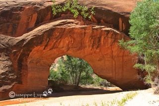
Cliff Arch

And finally at 3pm I was at the bottom of the sand dune. I had become already very tired, but now I had to master this last challenge. I took some photos in the middle of the sand dune where there is the best view to the whole panorama including Stevens Arch. Then again the three times walking back and forth in the Crack and the final 1.9 miles up to the trail head over slick rock and sand. I was back at the car at 5.30pm. I grabbed a fresh coke and drank it at once. I had carried too little water on this hike. A long hiking day from 5.30am to 5.30pm.

The drive back to Escalante took me 1h45. 10 miles along the Fortymile ridge road and then back on Hole in the Rock road.

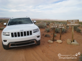
last 2 miles to the trailhead is deep sand

I had a short stop at Devil’s Garden of Grand Staircase Escalante, but came too late for good photos. Sun was already down to much.

Metate Arch in GSENM’s Devils Garden

Hiking Mileage today:   29 km / 18.1 miles

Hiking Mileage total:    91.8 km / 57.4 miles

curious incidents today:

1) meeting Joseph Holmes

2) Believe it or not. I hiked onto a snake while watching into my GPS. Luckily that snake was more frighten than me. Did not know that they can run that fast. What a coward. It was now rattler, but did not recognize what it is. Frightened myself I checked my legs for bites afterwards.

Related Posts:

Thursday, 18th of April 2013 at 08:53:21 PM

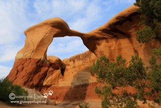
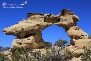
Canyonlands 2013 day 5: Horizon, Broken Bow and Sunset

This day was reserved for re-visiting Grand Staircase Escalante N.M. I choose Escalante because it has three iconic arches which I find photogenic and didn’t yet visit. (beside Broken Bow, which I revisited because I find it especially nice and easy to reach).

The first hike in the moring was to Horizon Archm which sometimes is also called Kissing Dragons. It is located on the Smoky Mountain backway (gravel road) branching off in Escalante directly close to my Hotel. The Trailhead is app. 10 miles south on the Smoky Mountain road. Road conditions were well, an easy drive. The hike was through several washes and then up a steep hill. Not easy to find, but I had GPS coordinates.

Horizon Arch (a.k.a. Kissing Dragons), Grand Staircase Escalante N.M.

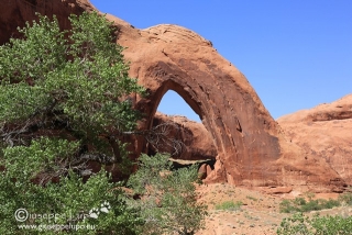
I was back at 12 at the car and drove to Escalante to buy some fruit and fuel and drinks. Then I took another gravel road, the Hole in the Rock road branching off from US12 approx 8 miles east of Escalante. Then a long drive of 42 miles on the 35mph rated gravel road to the trailhea for the broken bow arch. I did this hike already once in 2011 and liked both hike and Arch.

Broken Bow Arch, Grand Staircase Escalante N.M.

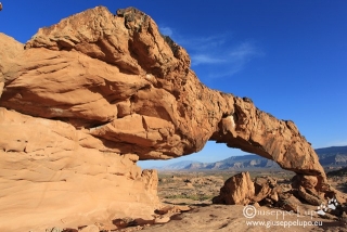
Finally I had to hurry to come in time for the  last sun at the Sunset Arch. It is located on Fortymile Ridge road and a very short hike.

Sunset Arch, Grand Staircase Escalante N.M.

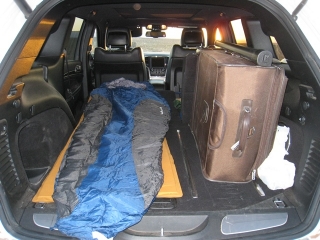
I choose this sequence of hikes because I wanted to overnight in the car at the Fortymile Ridge Trailhead. It is around 50 miles south of any civilization inmidst the wildness. I parked my Jeep at the trailhead and prepared for the night. My first Car-Camping ever.

Carcamping at Fortymile Ridge trailhead to Crack in the Wall

Hiking Mileage today:   21.6 km / 13.5 miles

Horizon (11 km) Broken Bow (6.7 km) Sunset (3.9 km)

Hiking Mileage total:    62.8 km / 39.3 miles

Related Posts:
Thursday, 18th of April 2013 at 08:52:39 PM

Canyonlands 2013 day 4: White Domes (Canaan Mountains)

My plan today was a strenous hike up to the White Domes on the Canaan Mountains. I had seen a foto of those brilliant white Domes and immediately wanted to see that in real. The hike was very exhausting. 3h cimbing uo to the peak, a total of 11 miles. The first part of the hike was along the Water Canyon. Then began the strenous part up a steep trail leading to Top Rock. From there it was another 1 1/2 mile to the White Domes.

arriving at White Domes peak

White Domes

driving Smithonian Butte Backway towards Zion

I started to the White domes at 7.50am and was back at the car at 2:30pm. The rest of the day was the transfer to my next base camp: Escalante, Utah. A 3h drive. I had plenty of time and decided to drive the Smithonian Butte Backway. It was in very good condition but not very photogenic. I took the chance to visit also the Ghost town of Grafton and the Grafton cemetary which are located at the north end of the Smithian Butte road.

view of Zion mountains

Then the long 3 h drive through Zion Mount Carmel Highway, US89N and passing Bryce Canyon, taking scenic byway US12 and arriving at 8pm in Escalante. Hungry  from the exhausting Whitedomes Hike I decided for Steak dinner at Circle D Eatery.


Hiking Mileage today:   16 km / 10 miles

Hiking Mileage total:    41.2 km / 25.8 miles

Related Posts: