Thursday, 18th of April 2013 at 09:03:49 PM

Canyonlands 2013 day 13: Colorado – Nautilus – Yelllow Rock

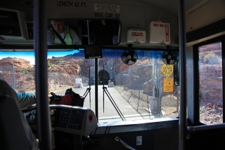
I had booked the 1/2 day Colorado River Discovery tour in Page. The tour started at 7.30 am with the bus transfer down to the Glen Canyon Dam base. That was quite interesting to drive endlessly down a dark narrow tunnel of 2 miles length. Due to the damaged US89 south the Raft tour had changed its programm. They not only drive down the river, but also bring the people back upstream with the rafts.

entry to 2 miles long Glen Dam tunnel

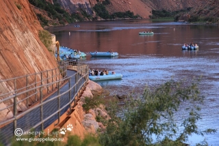
Down at the Dam base we had to wear hard hats until we were seated in the rafts. We started timely. A total of 7 rafts and approx. 8 people per raft.

entering the rafts

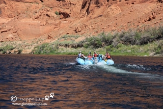
It was no real rafting experience because the Colorado was very calm. Right at the start, below the Dam we could observe several Great Blue Herons feeding their cubs in a nest high in a tree and fishing in the Colorado.

a peaceful Colorado river

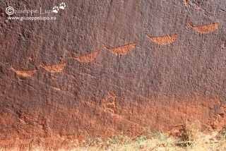
We stopped close to the Horseshoe Bend for a small Hike to the Anaszasi Petroglyphs.

Anaszasi Petroglyphs near Horseshoe Bend

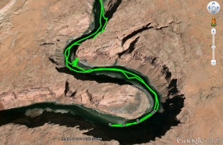
The Rafts turned at the end of Horseshoe Bend. It was possible to see the people up in the Horseshoe Bend Viewpoint from below. I visualized the turning point of my GPX track in Google Earth on the next photo.

GPX track of Colorado river turn point at Horseshoe bend visualized in Google Earth

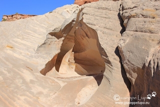
We were back at 12 am at the Colorado River Discovery agency, and I drove to the Hotel for a nap. Afterwards I wanted to stay at the pool until Dinner. But after 2 hours it got boring and I decided to visit the Nautilus. It is a sandstone formation near the White House trailhead 20 miles west of Page which I have had seen promising fotos in the Web. It is a small hike only to  reach the so called Nautilus and I took some photos.

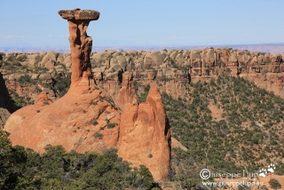
Nautilus

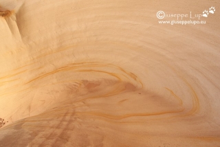
Nautilus detail from top

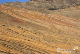
Being already near the Cottonwood Canyon Road I took the chance to revisit Yellow Rock, which is approx. 25 miles north of US89 on the CWCR. It was a spectacle to see the  amazing colors at the late evening light.

Yellow Rock on the Cottonwood Canyon Road

From the CWCR I drove directly to Dam Bar & Grille in Page where I had a fantastic Prime Rib with vegetables and garlic mashed potatoes. Afterwards back to the Hotel to write my day log and go to bed. Tomorrow the loop will be closed. I drive back to Las Vegas.

Hiking Mileage today:   7.3 km /  4.5 miles

(Petroglyphs 0.4 km / 0.25 mi +  Nautilus 1.8 km / 1.1 mi + Yellow Rock 5.1km / 3.2 mi)

Hiking Mileage total:    163.3  km / 102 miles

Related Posts:

Thursday, 18th of April 2013 at 09:00:29 PM

Canyonlands 2013 day 12: Eggshell Arch and transfer to Page, AZ

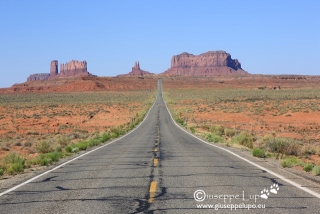
I had late breakfast in Bluff, UT and then continued my drive to my next stop in Page, AZ.I had finished my scheduled hikes and wanted to relax 2 days in Page, AZ and a last day in Las Vegas, NV before flying back to Munich and continuing office work routine. After passing Mexican Hat the Monument Valley Buttes came into sight. No need to say that a short photo stop was obligatory. ‘I had visited Monument Valley before and just drove by.

Monument Valley

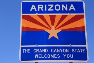
Shortly after Monument Valley after 10 days in southern Utah I entered Arizona, The Grand Canyon state.

Entering Arizona

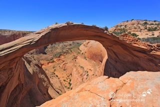
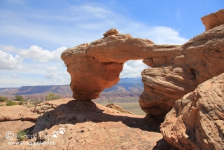
I had a final Hike in my backup list: The Eggshell Arch. This one is located in Navajo land and I was not sure If I just could enter there. I had read different opinions on the net. But the fact that fotos existed of that Arch encouraged me to just do it. It was a 7 mile side road on US95 towards Page leading into Navajo land. After a few miles the road turned into a dirt road and I parked my Jeep where the road became too rocky and sandy to continue by car. Two Navajo people where working on their field and one of them approached me when I stopped there. I was nervous but told that I would want to do a small hike of 2 hours and photograph an Arch. He said OK and I started towards Eggshell Arch. Once again I was too late for good photos on this sunrise location. I arrived at the arch at 11.30 am. Did my photos and hiked back. The GPS showed a hiking distance of 9.6 km ( 6 miles). The Navajos had been gone meanwhile, probably for lunch.

Eggshell Arch

I drove another hour and checked in at 2 pm at my Hotel in Page. I had some food and then went to the Pool. Now it was time for relax.

Hiking Mileage today:   9,6 km /  6 miles

Hiking Mileage total:    156  km / 97.5 miles

Related Posts:

Thursday, 18th of April 2013 at 08:59:44 PM

Canyonlands 2013 day 11: Needles District: Druid Arch + Chesler Park

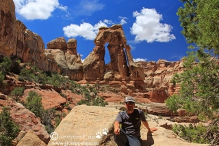
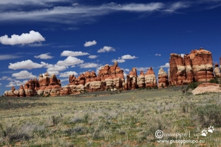
Today I wanted to visit the Needles District of the Canyonlands N.P. I started at 7 am from my Hotel in Monticello and drove 1h to the N.P. Visitor Center. Here I got info’s for my planed hike. It was a very long hike with several elevation changes.  Druid Arch is a gigantic Arch which inspired me from the first photo I had seen of it. I wanted to see it myself. The hike to Druid Arch is a good possibility to get to know the typical Needles Landscape. Chesler Park itself is a must see for visitors in the Needles district. I started my hike from Elephant Hill, went first to Druid Arch and took then the deviation on the return to see Chesler Park. At the evening I wanted to hike into Salt Creek, but it was closed due to Quicksand. Thus I drove back and found a cheap Motel in Bluff.

Me sitting high at the hill opposite to Druid Arch

Chesler Park

Hiking Mileage today:   24 km /  15 miles

Hiking Mileage total:    146.4 km / 91.5 miles

Related Posts:

Thursday, 18th of April 2013 at 08:58:28 PM

Canyonlands 2013 day10: Olympic + Tuku + Jeep + Corona + Bowtie Arch

At 5.30 I woke up, packed up the tent and prepared to continue the last ten miles of the White Rim Road. There was still one critical passage; The Hardscrabble climb, which gets impassable after rain. It had rained a little bit the day before, therefore I was tense. Luckily it was not wet on Hard Scrabble and I could manage this last obstacle quite relaxed. Knowing it is only 10 miles to the exit I could again enjoy the little challenges which the Rim Road provided: Stones, Rock, Sand, Drops Offs, etc. The road followed the Green River now and at 6 am the sunrise illuminated the sandstone in a glowing red.

sunrise on the last 10 miles of White Rim road

After exiting the White Rim road through the Horse thief Canyon switchbacks and leaving Canyonlands N.P. my plan today was to hike several less known places around Moab. First I visited the Olympic Torch, a small 1 mile hike at Moab’s Lions Park hills.

Olympic Arch in Moab’s Lions Park Hills

Then I drove 12 miles south of Moab to the Behind of Rocks recreation area to hike the Tukunivitz Arch.  8.6 km / 5.4 miles Hike.
Tukunivitz Arch in Moab’s Behind the Rock

Afterwards I drove again north of Moab to the Potash Road to hike the Jeep Arch. A 6.4km / 4 miles hike.
Jeep Arch at the Potash Road

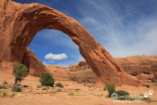
Finally I hiked the Corona and Bowtie Arches, also on the Potash Road. A small 3.6km / 2.2 miles hike.
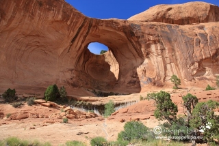
Bowtie Arch at the Potash Road

Corona Arch at the Potash Road

After the hikes I went to Moab to do a little bit of shopping and visit the Tom Till Gallery.

Hiking Mileage today:   20.2 km /  12.6 miles

(Olympic 1.6km Tuku 8.6km Jeep 6.4km Corona 3.6km)

Hiking Mileage total:    122.4 km / 76.5 miles

curious incidents today: After the hikes I visited the Tom Till Gallery in Moab. Furthermore I bought a water filter pump.

Related Posts:

Thursday, 18th of April 2013 at 08:57:11 PM

Canyonlands 2013 day 9: White Rim Road

In the morning I wanted to see and shot the sunrise at the Marlboro Point viewpoint. It is located at the Canyonlands N.P, entrance. Sunrise was at 6.06 am, thus I had to start from my Rodeway Inn Hotel in Moab (liked it) at 5 am.

Sunrise at Marlboro Point

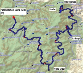
After Marlboro Point my big plan for this Sunday was to drive the legendary WHITE RIM ROAD (The 100-mile White Rim Road loops around and below the Island mesa top and provides expansive views of the surrounding area. Trips usually take two to three days by four-wheel-drive). I had requested a camp site early in February and had received Potato Bottom B camp. I was not aware what it means. Potato Bottom is the last campsite after entering into White rim Road at appr. mile post 65. This meant I would have to do 80% of the White Rim Road on one day to reach my night camp site.

Plan of my first day White Rim drive.

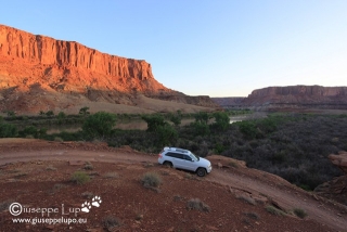
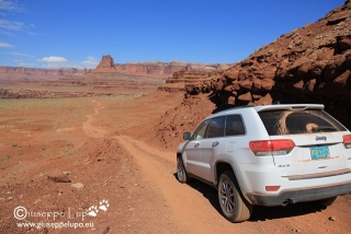
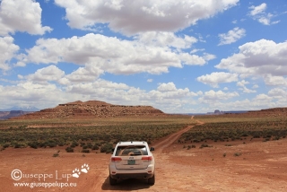
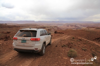
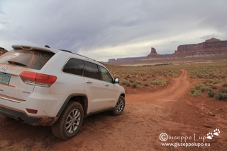
65 miles did not sound a problem so I started at 7.30 am into the White Rim Road adventure by driving down the Shafer switchbacks, Intimidating but easy to drive I did the Shafer trail the second time after 2011. I enjoyed the drive into White Rim Road and also visited the different scenic spots like Mussel-man Arch, drive down to Lathrop Canyon and parked the Car  next to Colorado river…..At 3pm  I arrived at the side excursion for the White Crack trail. There I met a guy from Aspen Colorado who told me he had been at Potato Bottom Camp the night before  and it took him 5 hours to drive to White Crack (he doing the opposite direction). It was then that I understood, that with my leisurely pace I would not arrive before night at my Camp Site. Nevertheless White Rim Road is not a road where it is possible to speed up. Usually due to the road condition the speed is around 5-10 mph. Weather  had worsened and it looked for rain. I had still the big obstacle “Murphy’s hogback” in front of me. A very steep and narrow climb with intimidating drop-offs. I arrived totally tired and shaken at 6pm at my camp. I had driven over 10 hours at an average of 6 mph. I had enough of the Off road experience for this day.

on the White Rim Road

on the White Rim Road

on the White Rim Road

on the White Rim Road

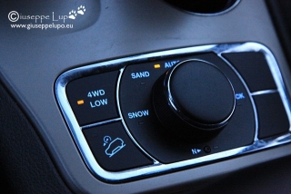
4WD LO was a great help on Murphy’s Hogback steep climb and down

I build up my tent Ate some sandwiches and  had 2 cold beers and then went sleeping at 9 pm. It was a pleasant night.

Me with Rental Jeep and Tent at Potato Bottom camp B

Hiking Mileage today:   3.2 km /  2 miles

Hiking Mileage total:    102.2 km / 63.9 miles

curious incidents today: I almost did not make it, before darkness to the Potato Bottom Camp.

Related Posts: