Wednesday, 16th of April 2014 at 09:43:38 PM

Arizona 2014 day 9: Arch Hunting in Chinle

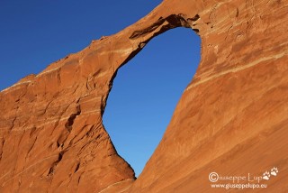
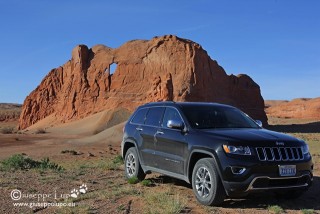
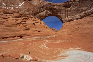
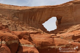
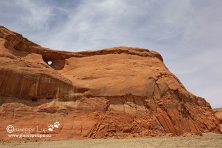
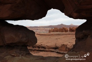
The 9th day of my fototrip I spent (Arch-) Hunting in Chinle, Az. I shot 6; Hope, Big Eye, and Window Rock north of Chinle, Az and the 3 Many Farms,Az arches (Window Rock, Strawberry and Tear drop),

Hope Arch

Window Rock, Chinle

Big Eye

Teardrop Arch

Window Rock, Many Farms

Strawberry Arch

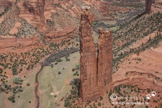
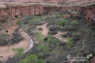
At the end of the Hunt I rewarded myself with Spyder Rock in Canyon de Chelly

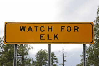
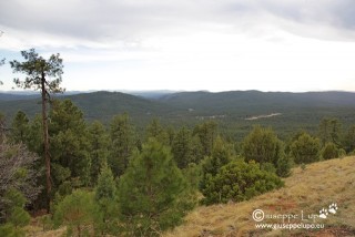
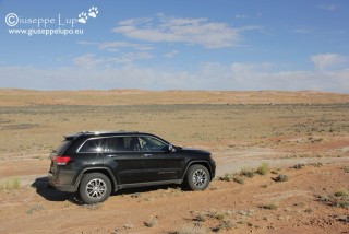
At the afternoon I drove from Chinle, Az to Phoenix. This is a 5h drive. I wanted to visit my friend Alex who lived and worked since a year there. I took  the 377 from Holbrook towards Heber and then the 260 passing Payson. It was astonishing to see the big Sitgreaves National Forest in that area, after having spent so many time in arid landscapes.

Related Posts:

Monday, 14th of April 2014 at 09:42:24 PM

Arizona 2014 day 8: Bisti Badlands + King of Wings

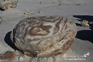
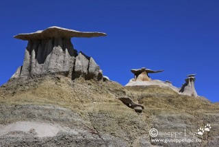
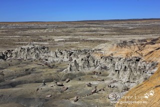
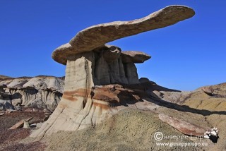
I had never had the chance to visit the Bisti Badlands in Western New Mexico which are a must for every USA Southwest geek. There are 3 major sections the Bist North and South sections and the Ashi-Slepa Wash Section. I visited them today all together and rounded this up with a visit at the King of Wings-the hoodoo with probably the longest and greatest hat of all.

“Cragged Egg” in the Bisti Southern Section

“White Hoodoos” in the Bisti North Section

Ashi-Slepa Wash

King of Wings

Related Posts:

Monday, 14th of April 2014 at 09:41:12 AM

Arizona 2014 day 7: Mission failed

My plan was to hike to Angel Arch in the Salt Horse Canyon area. It is a 27 mi / 42 km round trip hike from the Squaw Flat Trail head / Car Parking lot.

Having camped at Peekaboo would reduce the hiking distance to manageable 16 mi / 26 km (Car Park to Peekaboo is 5 miles – see day 6).

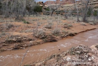
The night was very cold and chilly. Furthermore It began to rain at 4 am. Initially only shower but then getting heavy rain and windy. I  woke up through the rain blobs on the tent.  I had no experience in such a situation. I began to reason what to do and what could happen. As long as it rained I would stay in the tent.  I would not allow to get myself wet in this cold. But what if it rained the whole day ? I imagined to pass the whole day in the tent. I had enough food and water but would not be able to realize my long planed hike to Angel Arch. I set me a target: When it not sops to rain before 9 I will abort this mission – originally I wanted to start the hike at 6 am. The rain ended at 9:40 am and I went outside to check my backpack hanging in the tree. Later I checked the water-level of the Salt Creek and it had significantly swollen.
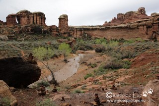
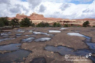
I knew now that I will not do this hike this year. During this hike it was necessary to travel the creek, thus getting wet was programmed. But now the stream was even strong and thus dangerous. I decided to wait a little bit for letting the tent dry up and then return the 5 miles back to the car park. Despite the continuing showers the hike over the rock was easy. What I had also not seen before, the pots in the stone I knew only empty where now filled with rain water, and one got the understanding how this pods develop .

At two locations the trail which was intact the day before was broken by a rain drainage water. An incredible strong stream where the day before was nothing.

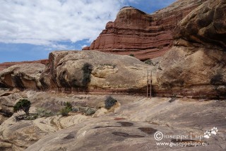
I still enjoyed this hike which is very picturesque and has also two ladder elements.

I arrived at the car at 2 pm and got rid of trash and dried/cleaned the tent. Went to the Visitor center to brush my teeth and drove off towards my next Basecamp: Farmington, New Mexico.

I entered the first time the state of Colorado and was surprised how the landscape changed totally into a green agrarian look with snow-covered mountains in the back. I decided to put Colorado onto my wishlist of next trips.

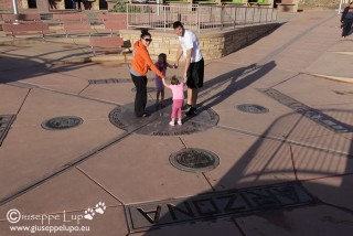
On the way I passed the Four Corner Monument where the states Arizona, Utah, New Mexico and Colorado meet.

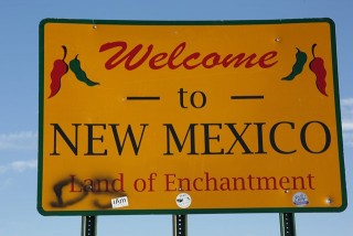
Then I drove into New Mexico leaving Arizona. I had passed 4 states today.

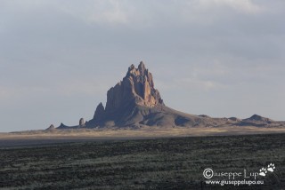
Approaching to Farmington one passes Shiprock which is  city and also a from far visible stone cathedral in the desert. Unfortunately I came a little bit late for meaningful photos at sunset.

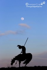
But a consolation was finding this constellation of the full moon and a native american ridden warrior.

I arrived in Farmington at my Hotel at 9 pm, after having fueled up, and filled up the ice chest with drinks and ice.

But one is for sure: The mission “Angel Arch” will be repeated soon.

Related Posts:

Monday, 14th of April 2014 at 08:46:49 AM

Arizona 2014 day 6: from Tuba City to Peekaboo

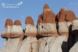
At 5 am I checked out from my Motel in Tuba City. I could reduce the price of the room by 50% because the shower provided only cold water. My first stop should be the Blue Canyon, located 40 miles off Tuba City. I had seen so often the photo of this white brown mushrooms that I wanted to go to this  location myself. It is a 26 miles dirt road which leads into the Blue Canyon where these formations can be found.

On the way back I took a wrong turn and ended in a dead end of rock slabs. The whole way up to there I thought myself – “this i not the route which I came from”. I had to drive backwards for half a mile cause it was not possible to turn.

Then I continued my road trip towards my next hiking destination; Canyonlands N.P. Needles District. A long drive and I had still to hike 5 miles on this evening to my campground.

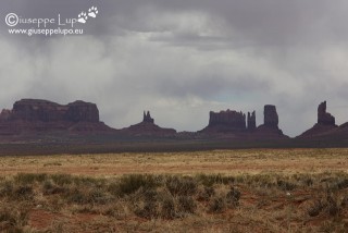
Once again I passed Monument Valley, like the year before. Of course one cannot pass without taking a photo.

I left Arizona and entered Utah, noticing weather gets worse. The blue Sky changed to black clouds.

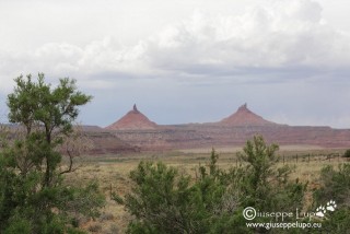
I arrived around 3 pm in Canyonland N.P. Needles District. The characteristic two Tit Buttes (that’s how i call them) are welcoming the visitors.

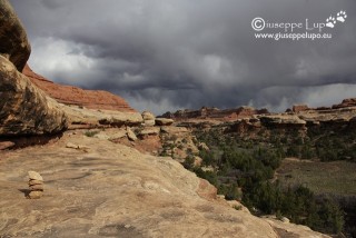
I went to the Back country office to get my permit for Peekaboo Camp in the Salt Horse Canyon and started my 5 mile hike at 3:30 pm. It was a short distance, but I had a heavy pack (including tent , sleeping bag, camera and tripod, and water for 2 days, and a glass bottle of Bud Lime Light) . Thus I was very tired when I arrived after approx 3 1/2 hours.  But the hike was very beautiful and the clouds amazing. I took many photos during the hike.

The trail lead also through a bird shaped hole in the rock.

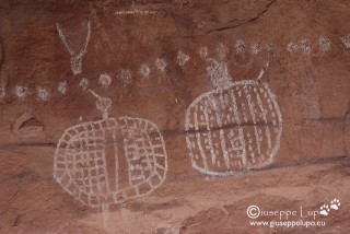
Just before arriving at the Campground, below the name giving Peekaboo Hole in the rock there is this ancient Indian pictograph at the wall.

When arriving at the Campground the view into Salt Horse Canyon showed a unremarkable water-level. But at this point of time I even did not evaluate its importance for the next hiking day. I build up my tent and ate some dry fruit and Beef Jerky and drank my single bottle of Bud Lime light.

I went to bed as soon as it got dark, at around 8pm. Nobody else was in the camp. I noticed that this was the first time in a remote location overnight without any other person close by in a neighbor camp. Must admit it was a little bit scary. Every strange noise outside makes you chill.

In the night it began to rain. No good.

Related Posts:
Saturday, 12th of April 2014 at 07:49:27 AM

Arizona 2014 day 5: from Rim to Bottom

Since my first visit of the Grand Canyon I had dreamed of going down and see the Colorado river from close. But all signs and guides discouraged to do it in one day. Thus I had tried for several years to book a night at the Phantom Ranch down at the bottom of the canyon. Always without success. A alterntive approach was necessary.

Two major trails lead from the South Rim towards Phantom Ranch : Bright Angel trail a 17 km long trail and South  Kaibab trail which is 10 km. The only Alternative left was to do the hike down and up in one day In Supai I met a guy who had done this before and told me some people do it starting at Kaibap trail (the one wothout water supply) and coming up Bright Angel trail, where there is usually water available at Indian Garden and the 3 and 1.5 Mile rest houses.

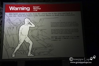
At 4:30 am I checked out at Maskwik Lodge and drove my Rental to Bright Angel Lodge, where I took a Taxi to the Kaibab Trail head. At 5 am I started in the dark with the headlamp and was reminded with the warning sign not to do it.

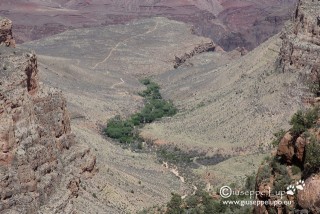
I had almost reached Skeleton Point some miles down when the sun rose.

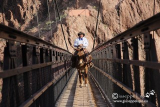
I reached the Kaibab suspension Bridge at the bottom at 7:50 am

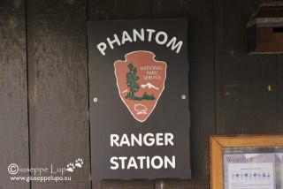
At 8 am I was at Phantom Ranch where I had a 30 min break,

Then the hard part began. Climbing up on Bright Angel trail to the Rim. First I crossed the Colorado over the Bright Angel Suspension Bridge and could take several photos on the trail which followed the river a while before ascending.

I arrived at Indian Garden at 11 am

I arrived at 2:10 pm at my Rental Car at the Bright Angel Lodge.

log of times:

5:00 am TH Kaibab (Rim)

7.45 am Kaibab Suspension Bridge

8:00 am Phntom Ranch  (Bottom)

11:00 am Indian Garden

2:10 pm Bright Angel Lodge (Rim)

GPS track and height profile of the hike:

My next Base camp was the small village of Tuba City, AZ. A short 90 min drive from Grand Canyon, I was so saturated from Grand Canyon that I didn’t stop on any of the viewpoints. I had them visited in the years before.

Related Posts: