Monday, 14th of April 2014 at 08:46:49 AM

Arizona 2014 day 6: from Tuba City to Peekaboo

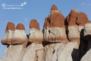
At 5 am I checked out from my Motel in Tuba City. I could reduce the price of the room by 50% because the shower provided only cold water. My first stop should be the Blue Canyon, located 40 miles off Tuba City. I had seen so often the photo of this white brown mushrooms that I wanted to go to this  location myself. It is a 26 miles dirt road which leads into the Blue Canyon where these formations can be found.

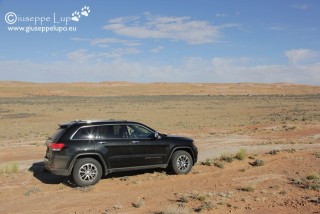
On the way back I took a wrong turn and ended in a dead end of rock slabs. The whole way up to there I thought myself – “this i not the route which I came from”. I had to drive backwards for half a mile cause it was not possible to turn.

Then I continued my road trip towards my next hiking destination; Canyonlands N.P. Needles District. A long drive and I had still to hike 5 miles on this evening to my campground.

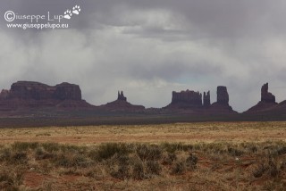
Once again I passed Monument Valley, like the year before. Of course one cannot pass without taking a photo.

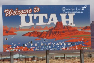
I left Arizona and entered Utah, noticing weather gets worse. The blue Sky changed to black clouds.

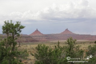
I arrived around 3 pm in Canyonland N.P. Needles District. The characteristic two Tit Buttes (that’s how i call them) are welcoming the visitors.

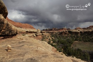
I went to the Back country office to get my permit for Peekaboo Camp in the Salt Horse Canyon and started my 5 mile hike at 3:30 pm. It was a short distance, but I had a heavy pack (including tent , sleeping bag, camera and tripod, and water for 2 days, and a glass bottle of Bud Lime Light) . Thus I was very tired when I arrived after approx 3 1/2 hours.  But the hike was very beautiful and the clouds amazing. I took many photos during the hike.

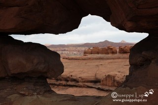
The trail lead also through a bird shaped hole in the rock.

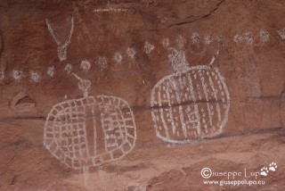
Just before arriving at the Campground, below the name giving Peekaboo Hole in the rock there is this ancient Indian pictograph at the wall.

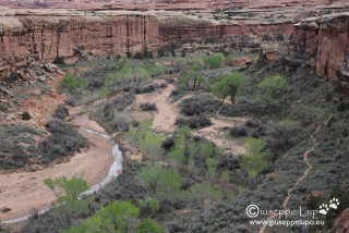
When arriving at the Campground the view into Salt Horse Canyon showed a unremarkable water-level. But at this point of time I even did not evaluate its importance for the next hiking day. I build up my tent and ate some dry fruit and Beef Jerky and drank my single bottle of Bud Lime light.

I went to bed as soon as it got dark, at around 8pm. Nobody else was in the camp. I noticed that this was the first time in a remote location overnight without any other person close by in a neighbor camp. Must admit it was a little bit scary. Every strange noise outside makes you chill.

In the night it began to rain. No good.

Related Posts:

Saturday, 12th of April 2014 at 07:49:27 AM

Arizona 2014 day 5: from Rim to Bottom

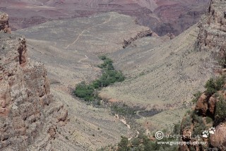
Since my first visit of the Grand Canyon I had dreamed of going down and see the Colorado river from close. But all signs and guides discouraged to do it in one day. Thus I had tried for several years to book a night at the Phantom Ranch down at the bottom of the canyon. Always without success. A alterntive approach was necessary.

Two major trails lead from the South Rim towards Phantom Ranch : Bright Angel trail a 17 km long trail and South  Kaibab trail which is 10 km. The only Alternative left was to do the hike down and up in one day In Supai I met a guy who had done this before and told me some people do it starting at Kaibap trail (the one wothout water supply) and coming up Bright Angel trail, where there is usually water available at Indian Garden and the 3 and 1.5 Mile rest houses.

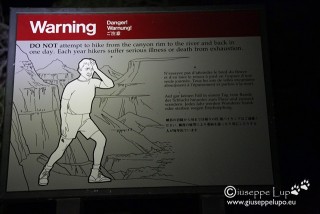
At 4:30 am I checked out at Maskwik Lodge and drove my Rental to Bright Angel Lodge, where I took a Taxi to the Kaibab Trail head. At 5 am I started in the dark with the headlamp and was reminded with the warning sign not to do it.

I had almost reached Skeleton Point some miles down when the sun rose.

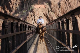
I reached the Kaibab suspension Bridge at the bottom at 7:50 am

At 8 am I was at Phantom Ranch where I had a 30 min break,

Then the hard part began. Climbing up on Bright Angel trail to the Rim. First I crossed the Colorado over the Bright Angel Suspension Bridge and could take several photos on the trail which followed the river a while before ascending.

I arrived at Indian Garden at 11 am

I arrived at 2:10 pm at my Rental Car at the Bright Angel Lodge.

log of times:

5:00 am TH Kaibab (Rim)

7.45 am Kaibab Suspension Bridge

8:00 am Phntom Ranch  (Bottom)

11:00 am Indian Garden

2:10 pm Bright Angel Lodge (Rim)

GPS track and height profile of the hike:

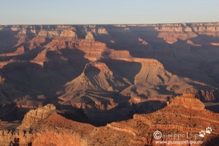
My next Base camp was the small village of Tuba City, AZ. A short 90 min drive from Grand Canyon, I was so saturated from Grand Canyon that I didn’t stop on any of the viewpoints. I had them visited in the years before.

Related Posts:

Friday, 11th of April 2014 at 09:40:23 AM

Arizona 2014 day 3, 4: Supai Village

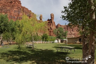
I started at 5 am from my Motel in Kingman, Az on historic Route 66 towards Peach Springs, which I reached after 40 min. Then a road in northern direction lead to Havasupai Hilltop where there is a big parking lot at the trailhead down to Supai Village. The trail to the village is about 8 miles. I started from the Parking at 7:20 am. The trail leads after a steep descent into  a wide canyon which narrows slowly. The hije is very enjoyable and I did many phots of the canyon and the traffic in the canyon (Muli coming up from Supai with US post, backpacks and visitors)

I arrived at 11 am at Supai Village where I went to the Campground registration desk and got my badge and paid my fee.

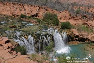
Then I had lunch in the cafeteria, a Supai Burger. I also wrote postcards and dropped them in the Post office oppsite to the cafeteria. Supai, Az is the only village in US where the post is transoirted on Mulis. Then I continued the Hike towards the Campground passing at Navajo falls.

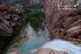
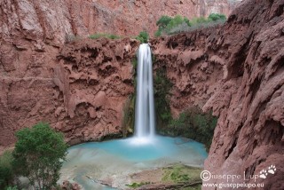
I reached the campground after 1 pm and build up my tent.I had the whole afternoon and the following morning to visit the falls and take pictures. My favourite was Mooney Falls, to which bottom i descendet twice.

On the next day at noon time I packed my tent and backpack ant hiked back to Supai Village. There I took the helicopter up to the Parking at Havasupai hilltop. A short 4 min flight. I had decided to use the helicopter, because on the following day I had a very strenous hike on the plan: The “Grand Canyon South – Rim to Bottom in 1 day”. Thus my next basecamp was Grand Canyon South where I had booked a room in Maskwik Lodge. I arrived at sunset and had time to go to Materpoint to see the sunset there.


Related Posts:

Friday, 11th of April 2014 at 09:39:14 AM

Arizona 2014 day 2: Alabama Hills + Trona Pinnacles

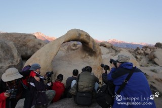
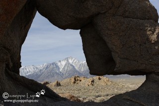
The Alabama Hills close to Lone Pine, was often used in Hollywood films as filming location. It is also known for its beautiful arches and the breathtaking laandscape. I drove up to the Hills in the dark and it was not easy to orientate due to lack of light or signs. But luckily I had GPS. At sunrise I wa at Moebius Arch, the best known of the Alabama Hill arches A group of chinese photogrphers had already occupied the arch so I had to wit for my turn.

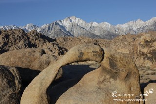
Personally I liked the view after sunrise when all the shade on the arch is away more. I waited herefore around 1 hour at the Moebius arch.

Afterwards I hiked the small loop to see the other arches close to Moebius. Later I moved to other locations for more arches. My favourite was the Boot arch. All arches are not easy to find due to missing signs.

I used this landscape also for a souvenir shot of my Ford Explorer Rental. I had decided that the car is too big for me and I really felt uncomfortable with it. I wanted to return it as soon as possible.

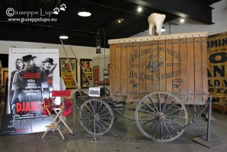
After having seen all arches in the Alabanma Hills it was noon and I made a short stop at the  Lone Pine Film Museum which exhibits artefacts of many historic movies shot in the hills. I was surprised to find also the original carriage of Dr. King Schulz from Tarantinos latest Movie Django Unchained. A ffew scenes had been shot too in the Alabana Hills.

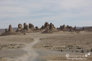
The next target was Kingman, Az. I planed my route so to pass by the little town of Trona, Ca to have a look at the pittoresque Trona Pinacles.

Then I had a long drive to Las Vegas and exchanged the Ford Explorer with a small Jeep Grand Cherokee. I felt immediately at home when driving the Jeep. Finally I drove another hour south towards Kingman, Az where I took a Hotel at the historic Route 66.

This day was a long driving day.

Related Posts:

Tuesday, 8th of April 2014 at 08:45:12 AM

Arizona 2014 day 1: Las Vegas + Death Valley

I had arrived the night before at 10 pm. The Alamo Choice Line was completly empty on this late Sunday night, No Compact or Standard SUV at all. Luckily a Ford Explorer came in. I would have liked to drive again the Jeep Grand Cherokee like in the years before. Especially after last years White Rim Drive, I knew the Jeep well. But the Ford Explorer looked not bad neither-and it had different off toad programs, true 4WD, rear cam and thus I took him. I woke up early after  a short night, Thus I went to Walmart to buy Ice chest and drinks as well as trail food. Then (it had become a tradition) I went to Bellagio breakfast buffet. Good as always.although they had reduced the choice of dishes. Afterwards I drove with the Ford Explorer behind the Flamingo building to have a look at the brand new Las Vegas High Roller ferris wheel. It had opened just 7 days before. The High Roller is now ranked world biggest ferry wheel, taller than the London Eye and other.

The brand new Las Vegas High Roller seen from Koval Lane

Originally I had planned to stay 2 days in Vegas and relax from office, drinking some beers at the Pool. But I had also a Plan B, which was revisting Death Valley. This would be to fight my 2013 trauma where I had a flat tire on in the Death Valley on my first trip day. I choose Plan B and left Vegas already after 12 hours, taking Blue Diamond Road (Nevada state route 160) which is a nice scenic drive. Arriving in Death Valley I drove up to Dantes View, where I had been the last time in 2004.

Dante’s View iinto Death Valley

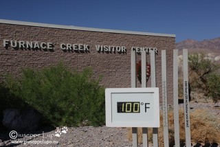
My major destination where the Mesquite Sand Dunes at Stopevipe Wells. I hadn’t been there before and was thus quite curious. Before driving to the Sand dunes I revisted Bad Water and had a walk on the salt flats. At Furnace Creek I bought a Anual Park Pass for 80 USD. The Furnace Creek Visitor Center thermometer showed already 100°F (38°C).

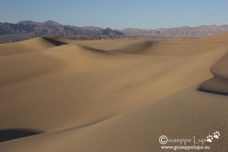
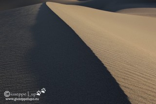
Around 5 pm I arrived at the Mesauite Sanddunes where I hiked 3 miles in the dunes and stayed until sunset taking photographs

.


Related Posts: